
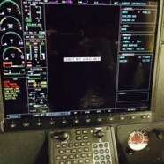
Image 1: G1000 “CHART NOT AVAILABLE” error message (for KBDU, Boulder Municipal, CO)
Recently, the owner pilot of a G1000 equipped TBM 850 posted a picture of his MFD and asked for advice about the error message “CHART NOT AVAILABLE” as he was viewing information for KBDU (Boulder Municipal Airport, Boulder, CO). (Image 1)
He had already contacted Jeppesen tech support but came away with the impression that perhaps he had a problem with his downloaded data or his subscription did not include charts. It is important to understand that the word “CHART” in this on-screen message refers to what most pilots still call a “plate”. Back when no one had PFDs, MFDs, EFBs or iThings, instrument pilots had only paper products to help them navigate from airport to airport and that paper consisted principally of “charts” and “plates”. “Charts” being short for navigational charts or maps, e.g. Sectional, WAC, Lo IFR, Hi IFR charts. “Plates” on the other hand referred to departure/arrival/approach procedures, airport diagrams and some miscellaneous pages published (in slightly different formats) by both NOAA and Jeppesen, all of which were identified with a certain airport or group of airports in a single metropolitan area. Garmin contrarily refers to their electronic version of these plates as “CHARTS”. If you learned on G1000 hardware, this is not too confusing because Garmin flight decks have never displayed an electronic version of any of the navigational charts mentioned above. Instead they show a plan view of your aircraft on a moving map of Garmin’s own design. This method certainly has its advantages, the most obvious being that icons and text are automatically sized and rotated so as to be easy to see and read regardless of the selected scale or orientation of the moving map. If however, you learned to fly when a “chart” was a paper navigation chart, you will need to learn Garmin’s vernacular before you can comfortably sit behind a Garmin flight deck. To “G-whiz” pilots (my own jargon for those with a working knowledge of G500/600 MFD/PFDs, G1000/3000/5000, Perspective/Prodigy flight decks or GNS 650/750 navigators) a CHART is one of the family of what you may know as a “plate”. With that bit of instrument flying vernacular history out of the way, we can now address the cause of the “CHART NOT AVAILABLE” error message shown in the picture above.
In this case, it is simply that even though this TBM has a Jeppesen subscription that includes all the Jepp plates in electronic form, no Jepp plates or “CHARTS” exist for the selected airport (KBDU). It seems obvious enough that if there are no instrument procedures for a particular airport, none would be available to view; but what about an airport diagram? Pilots who use the popular Foreflight EFB app to view (or even load to a moving map) the airport diagram might be a bit confused by the fact that Jeppesen does not provide airport diagrams for airports that do not have any Instrument Approach Procedures (IAPs). (Not to be outdone by Garmin in pushing the evolution of the ICAO’s prescribed universal aviation language, Jeppesen savvy pilots refer to a Jepp airport diagram as a “dash 9” because all Jepp plates contain index numbers and the airport diagram is always indexed as XX-9). So to recap, for a Jeppesen subscriber, regardless of whether you are looking at paper or the biggest baddest newest flight deck on the planet, No IAPs = No dash 9. You’ll have to find another way to find your way around on the ground there. Fortunately, Garmin has a solution to that problem in the form of Safe Taxi Diagrams. These are generated, not by Jeppesen, but by Garmin’s in house flight data division in a similar manner to the rest of the data that is incorporated into the moving maps available in the “MAP” chapter featured in all of the above mentioned Garmin hardware.
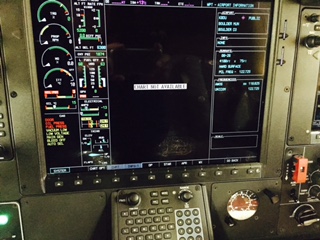
If you have Jepp FD loaded on an Ipad, you can see if this will be an issue as you plan your flight using the app. (If not, and you have a Jepp subscription for a Garmin flight deck, Jepp FD and the subscription data for it are no additional charge so you might consider loading it on your iPad even if you use another EFB app such as Foreflight, WingX Pro, or Garmin Pilot.) Try creating a flight in Jepp FD from KAPA (Denver Centennial Airport) to KBDU. When you look at the route you will see the KBDU airport symbol and identifier in green, while KAPA is blue. The green airport symbol and identifier indicates that KBDU has no IAPs. KAPA however, has a blue diagram and label indicating that it has at least one instrument approach. (Image 2)
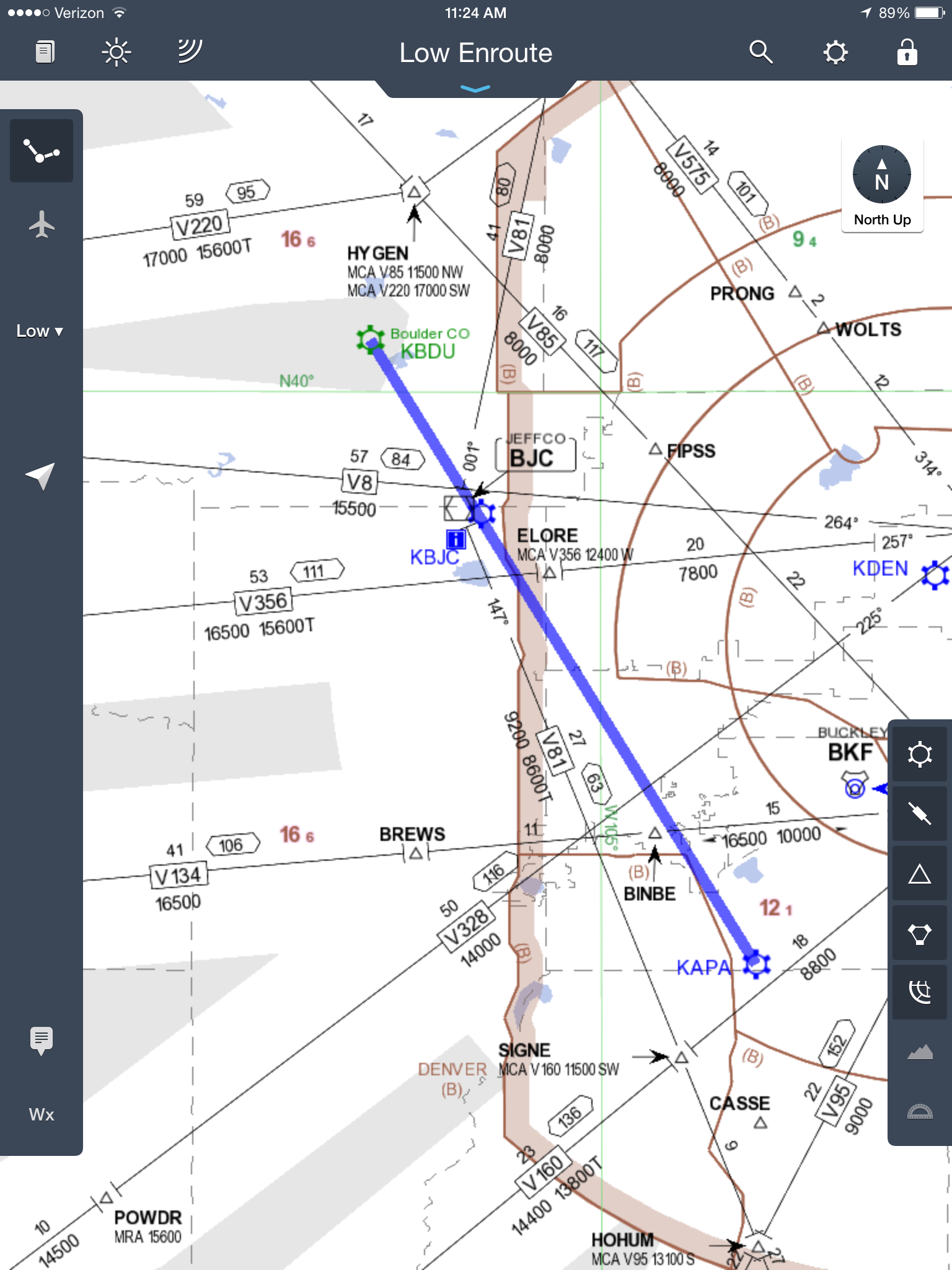
Image 2: APA to BDU Lo Alt Chart in Jepp FD on iPad mini
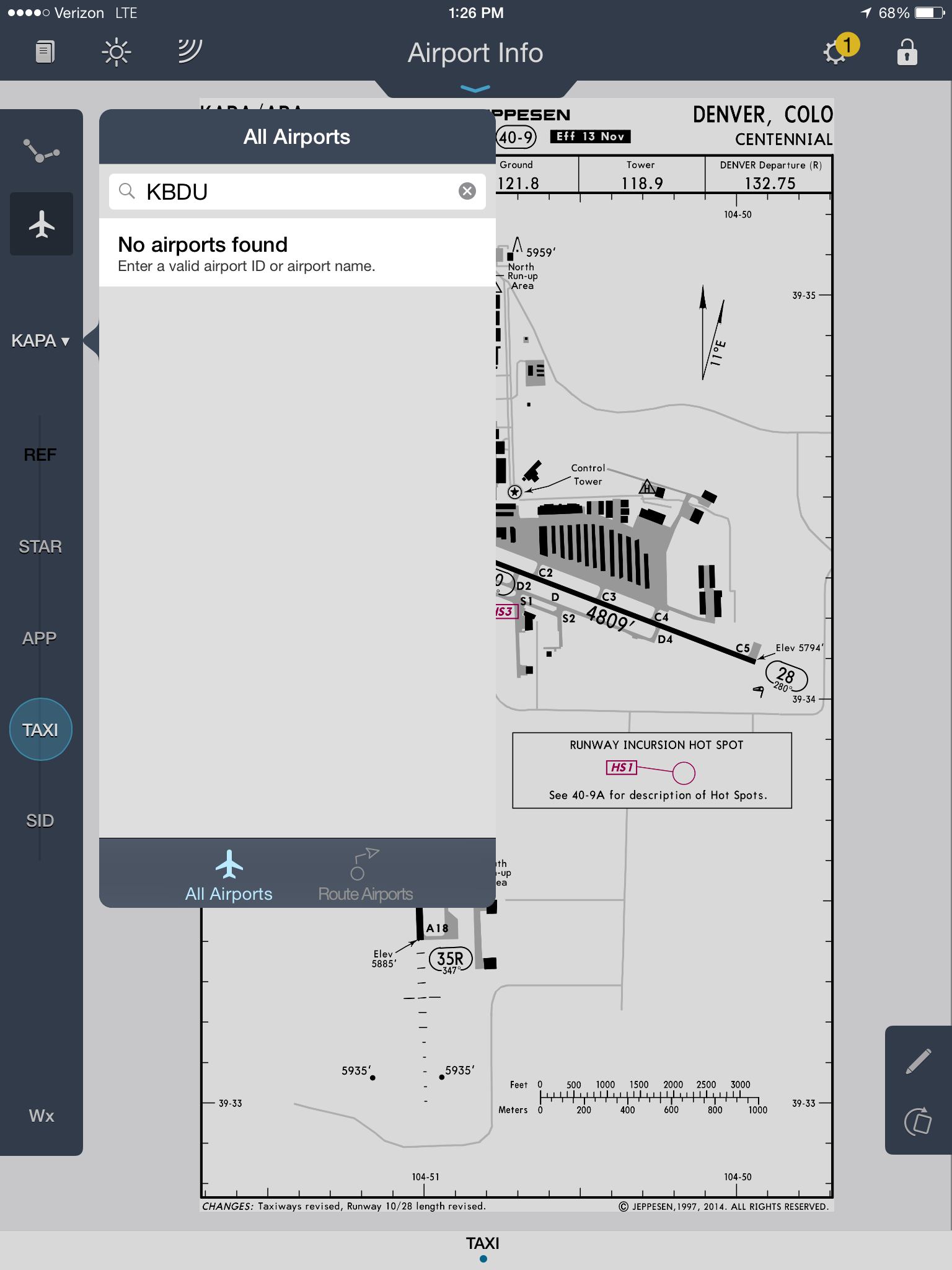
Image 3: KBDU “No Airports Found” error message in Jepp FD on iPad mini
You will also note that if you touch the ownship (airplane) symbol along the left hand toolbar and then the APT drop down icon just below it (instead of APT it may have the identifier of the last airport you entered there) you will get an error message “No airports found” even though the airport is in the Jepp FD database. (Image 3) In my opinion, this error message is confusing and should be changed to read “No Charts/Procedures available for this airport”. I have suggested this to Jeppesen but unless/until they decide to make the change, you will just have to remember that in this case, “No airports found” is Jeppesen for “no airports with IAPs found”
Although many general aviation pilots prefer Jeppesen charts/plates, you have to remember that their background is steeped in part 121 operations. US air carriers, their biggest customers, seldom if ever use VFR only airports. If Jepp included dash 9 airport diagrams for all of these airports, the airline guys you occasionally still see toting heavy cases full of those binders would need a luggage cart and steamer trunk to carry all that extra paper.
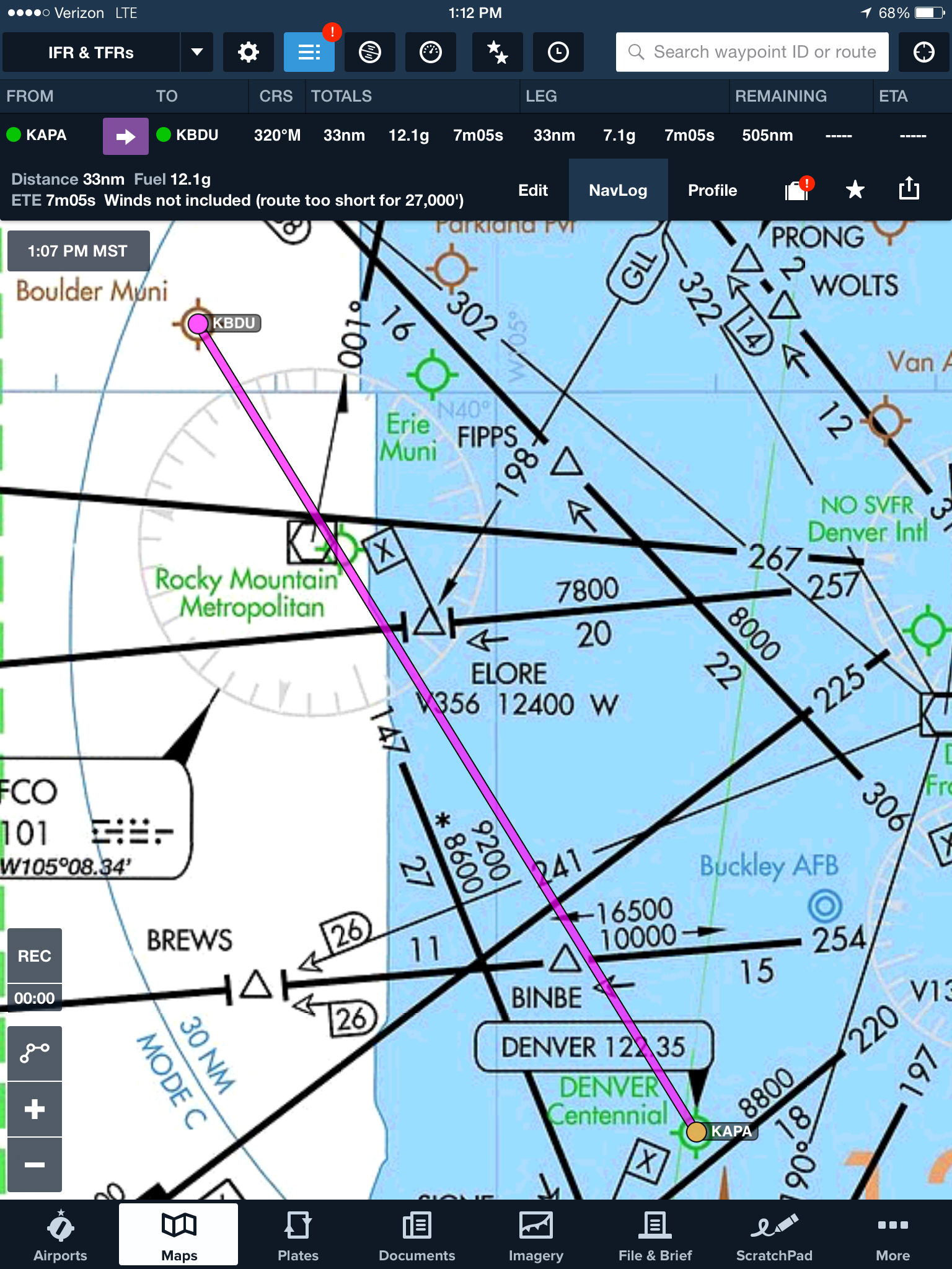
Image 4: KAPA to KBDU Lo Alt route in Foreflight on iPad mini

Image 5: KBDU Foreflight Taxi Diagram loaded to Lo Alt map on iPad mini
For comparison, I have included similar images from my iPad mini using Foreflight. The first screenshot (Image 4) is the same route (KAPA to KBDU). The second (Image 5) is the route zoomed in after loading Foreflight’s airport taxi diagram to the map. While they all have their limitations, these EFB apps are hands down the best value in aviation situational awareness tools. Even Foreflight does not provide airport diagrams for some very low use airports, though it does include airport diagrams for a great many VFR/no IAP airports, including in this case KBDU. As a mentor and CFII, I strongly recommend all pilots familiarize themselves with one or more of these EFB apps. If you are fortunate enough to own the aircraft you fly I would also encourage you to work with your avionics shop to install a powered mounting solution for your choice of tablet. A very popular choice for a number of different aircraft was designed by TBM pilot and owner, Steve Silverman. His QR Mounts (http://www.qrmounts.com/) feature excellent design and manufacturing, are an exceptional value, and hold your iPad conveniently in front of the yoke. I have recommended them to every TBM owner I fly with and they have been well received in every case. I have no affiliation with or receive any compensation for promoting Steve’s products. I recommend them only because my experience shows that they are a great tool. Properly used, they can keep your favorite EFB app up and running where it is easy to see and manage: one important part of an intelligent risk management strategy that can help pilots maintain situational awareness in the busy world of single pilot instrument flying in high performance aircraft.